Last year I spent a weekend in the Mallee region on a reconnaissance trip for potential future Sandhurst 4WD Club trips. Several parks are within a reasonable drive from Bendigo – Wyperfeld National Park, Murray-Sunset National Park, Hattah Kulkyne National Park, Little Desert, Big Desert, Ngarkat Conservation Park. This is definitely worth a look-in when you’re after a break from the Alpine regions.
We are well placed for access to the Mallee Parks in Central Victoria (Hopetoun is 2 hr 50 min from Bendigo), so the travel distance makes it easily do-able on a long weekend. The other bonus – in the cooler months – it’s usually around 4 degrees warmer than Bendigo, so during late autumn, winter and early spring when the weather is cooler and the high country tracks are subject to seasonal closures, it can be a nice break from the cooler South of the state.
Don’t come here in Summer – it’s very hot, dry and bees are a big problem especially around open water. Early autumn and late Spring months can be on the hot side, so just pick your time of year. We did this trip in late August after moderate rain, it was cold overnight, but quite pleasant during the day, there had been enough rain to make sure the sand wasn’t too soft, but not enough to create huge bog holes.
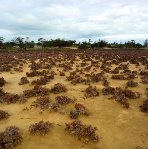
We decided to explore the east side of Wyperfeld and Murray-Sunset, leaving Bendigo at 5.30am we started at Wonga Camp Ground and mostly stuck to the Mallee Drive Touring Route (part of the Iconic 4WD Adventure series published by Parks Vic and FWDV). Aside from some soft sand here and there, it’s not very technically challenging so if you’re after hard stuff you’ll be disappointed, this trip is really about exploring the ever changing desert landscape, taking in the scenery and wild life and enjoying some great camping locations.
Day 1 – Wonga Campground to the Pink Lakes
Fuel up in Hopetoun at Hopetoun Fuel and Nursery (big thumbs up to the owners, who are always accommodating). Take the road into Wyperfeld Park and head to Wonga, which is a large campground with good facilities (fees apply). This is a good first camp if you’re heading up after work on a Friday.
We aired down at the camp ground, and took Dattuck, North South and Eagle Track to Casuarina Campground. We did encounter soft sand on this track, but it wasn’t too much of a challenge in the conditions. Casuarina campground is named after the Casuarina pines that dominate the landscape, after passing through mostly sandy desert, it was interesting to see the pines – most people think the desert is pretty boring, but we always marvel at how diverse and varied it actually is. You can camp free at Casuarina, but there’s not really much to see there, I recommend pushing on to Snow Drift if you’re looking for a good camp in this part of the park.
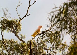
After a quick poke around at Casuarina, we headed into Snow Drift for lunch. On the way in, we stopped to look at some pink cockatoos. Snow drift is a free camp ground and picnic area next to a huge sand dune – great place to camp, and stop with the kids for a run up and down the dune (bring a boogy board or something to slide down the dune, if inclined)
-

- View from top of Snow Drift Dune

-
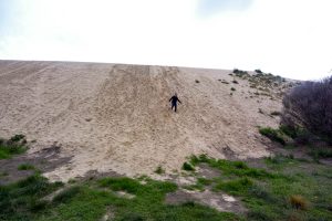
- Tim Running down the sand dune at snow drift picnic area

-
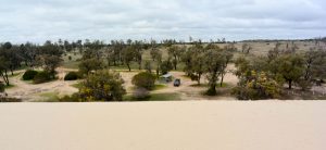
- View of camp ground from top of sand dune at Snow Drift Picnic Area

-

- Snow Drift Picnic Area

-
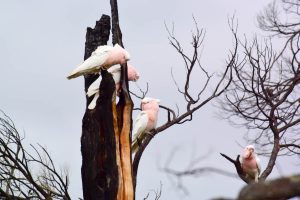
- Pink Cockatoos on the road to Snow Drift Picnic Area

From snow drift we passed through Wirrengreen plain, you can go on a short walk to check out O’Sullivan’s lookout (we didn’t have time). We encountered lots of Emu’s and Kangaroo’s driving through the plain – watching the emu’s run across the plains in packs is really cool.

Emu’s on Wirrengreen Plains
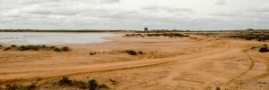
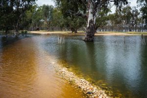
Leaving the park and driving into Underbool, we took the Mallee Highway a few minutes and turned off to the pink lakes, which mark the entrance of Murray-Sunset National Park. We stopped at Lake Crosbie, which is the larger camping area (there is a smaller one at Lake Becking). Both lakes are fairly exposed, and not a great place to camp if you get any wind. They also attract caravans, because they are 2WD accessible. The lakes are a good photo opportunity, the water looks pink because of the red pigment.
Unfortunately we got both wind and rain that night, despite the all clear from the forecast. I suppose it’s a risk you take doing this trip in winter. In hindsight Mt Crozier Campground (about 30 mins drive from the pink lakes), would have been a better spot.
-
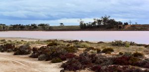
- Pink Lakes – Lake Crosbie

-

- Pink Lakes – Lake Crosbie

-
- Vegetation on the shore of Lake Crosbie

-
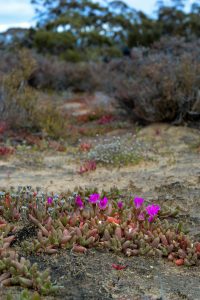
- Vegetation on the shore of Lake Crosbie

-
- Pink Cockatoo at Lake Crosbie

-
- Camping at Lake Crosbie

Day 2 – Pink Lakes to Lake Mournpall
We left Lake Crosbie and continued on Mt Crozier track, going past Mt Crozier campground. This is a 4wd-only accessible free camp, and this would have been a great place to stay for the night. In general the driving was quite easy, there was a lot of water on the tracks, so the Patrol got quite a bath. It pays to drive around the bog holes where possible, the bog holes in the area have a reputation for being deceptively deep compared to what you see in the high country, and since this was a solo trip, we didn’t particularly feel like getting stuck and having to do a single vehicle recovery.

On the tracks in Murray-Sunset National Park
Continuing through the ever-changing landscape, we headed North up Underbool Track. The original plan was to check out Rocket Lake and then head across to Shearers Quarters for the night, but the driving on Pheenys track was not particularly interesting, and rather than place us 5 hours from Bendigo for the drive home, we decided to leave Murray-Sunset and head to Hattah-Kulkyne for the night.
We completed the loop via Midnight Tank Track, which took us to Rocket Lake Campground – set amongst dunes uphill from the lake. Quite a nice location for camping, and it looked like the area had plenty to explore on foot. We had lunch at Rocket Lake and then head back to Pheenys Track heading East.

Coming into Rocket Lake
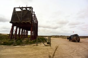
This section of Pheenys Track (which becomes Last Hope Track) exiting the park through Raak Plains (state forest) is very interesting, you are faced with bush to the left, and a wet land area to the right, and the track was quite slippery in places. From the horizon, arises a strange looking structure, which on closer inspection turned out to be a loading area for an abandoned Gypsum mine.
-
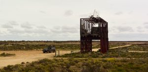
- Gypsum Loading Bins in Murray-Sunset National Park

-
- Abandoned Gypsum Mine at Murray Sunset National Park

-
- Top of a small dune in Murray Sunset National Park

-
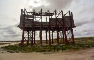
- Gypsum Loading Bins in Murray-Sunset National Park

-
- Gypsum Loading Bins in Murray-Sunset National Park

-
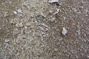
- Gypsum

Last Hope Track exits the park through private farmland, we turned onto the freeway for a couple of kms, and then turned off to get into Hattah Kulkyne – destination: Lake Mournpall.
-

- On the road out of Murray-Sunset national Park

-
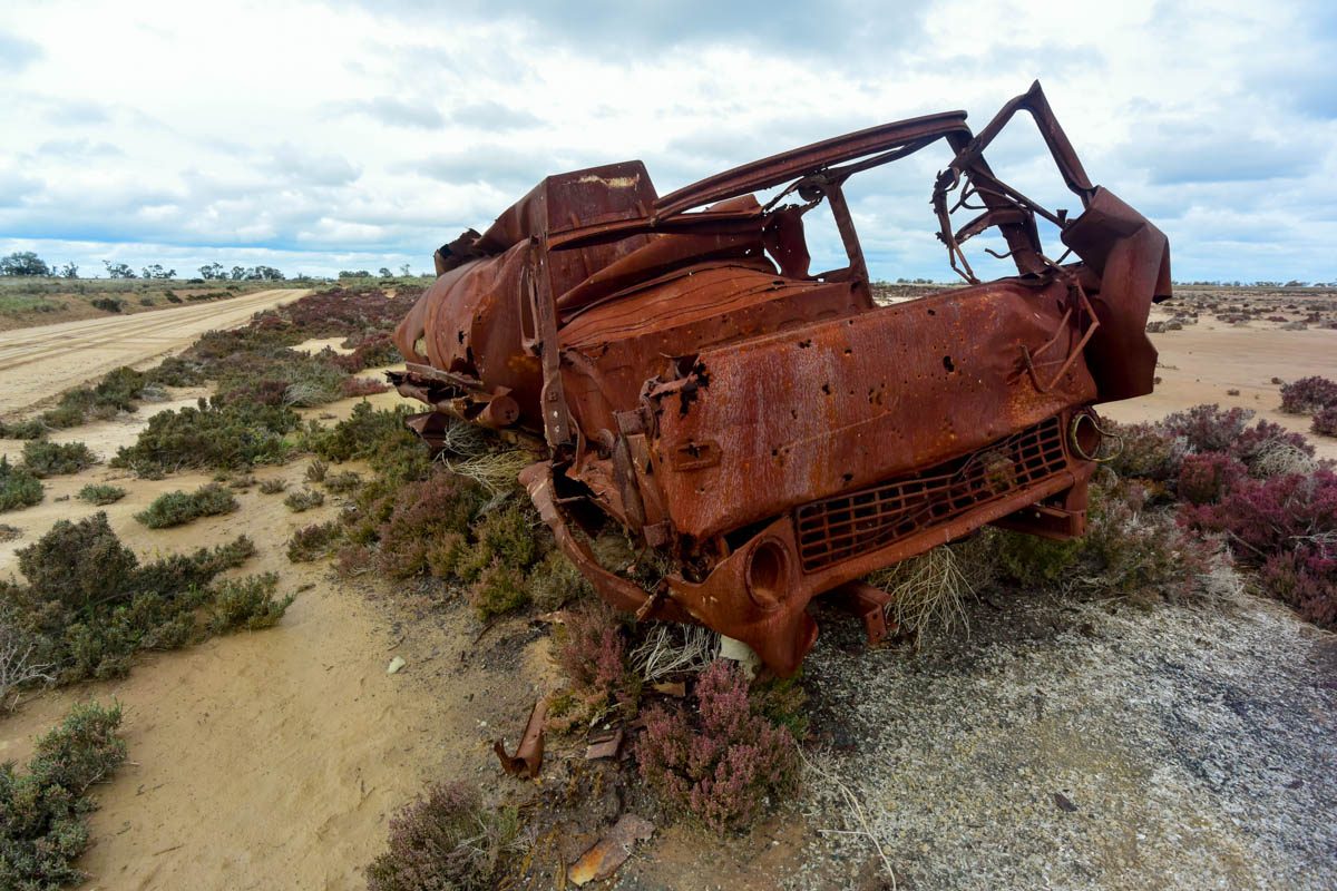
- Rusted out truck on the road out of Murray-Sunset national Park

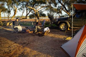
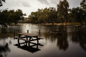
Hattah isn’t really considered a ‘4wd destination’) and whilst many of the tracks in Hattah are listed as ‘4wd only’ they’re not challenging, but they’re quite scenic, so we enjoyed the drive into the park and set up camp in the campground by the lake (fees apply) amongst ancient redgums. We had quite the calm night and with the campground to ourselves we were able to kick back around the fire and enjoy a beer.
-

- Ancient River Red Gums at Lake Mournpall
-
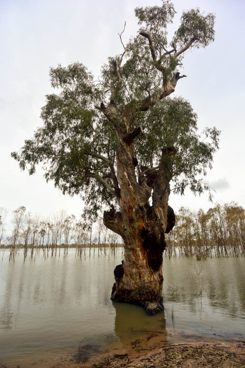
- Ancient River Red Gums at Lake Mournpall

-
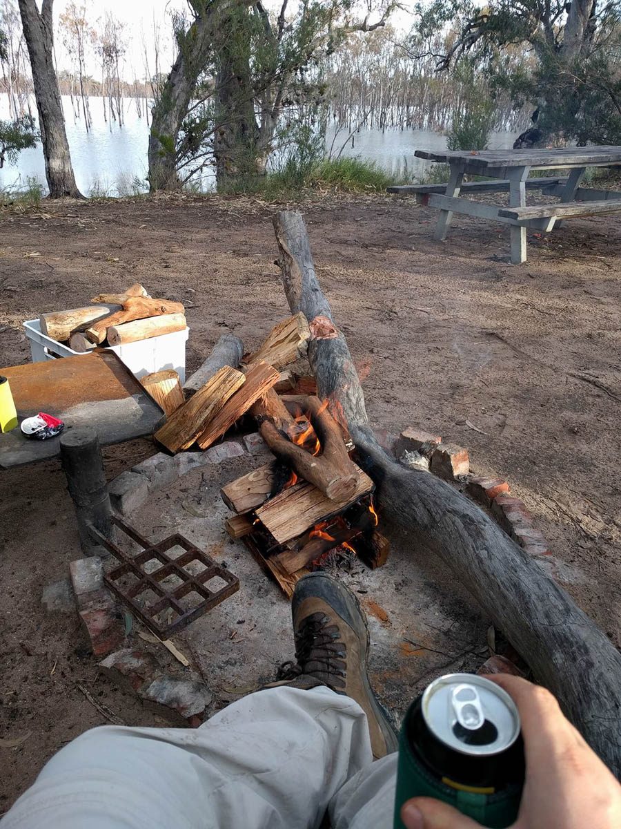
- Kicking back with a beer at Lake Mournpall

-
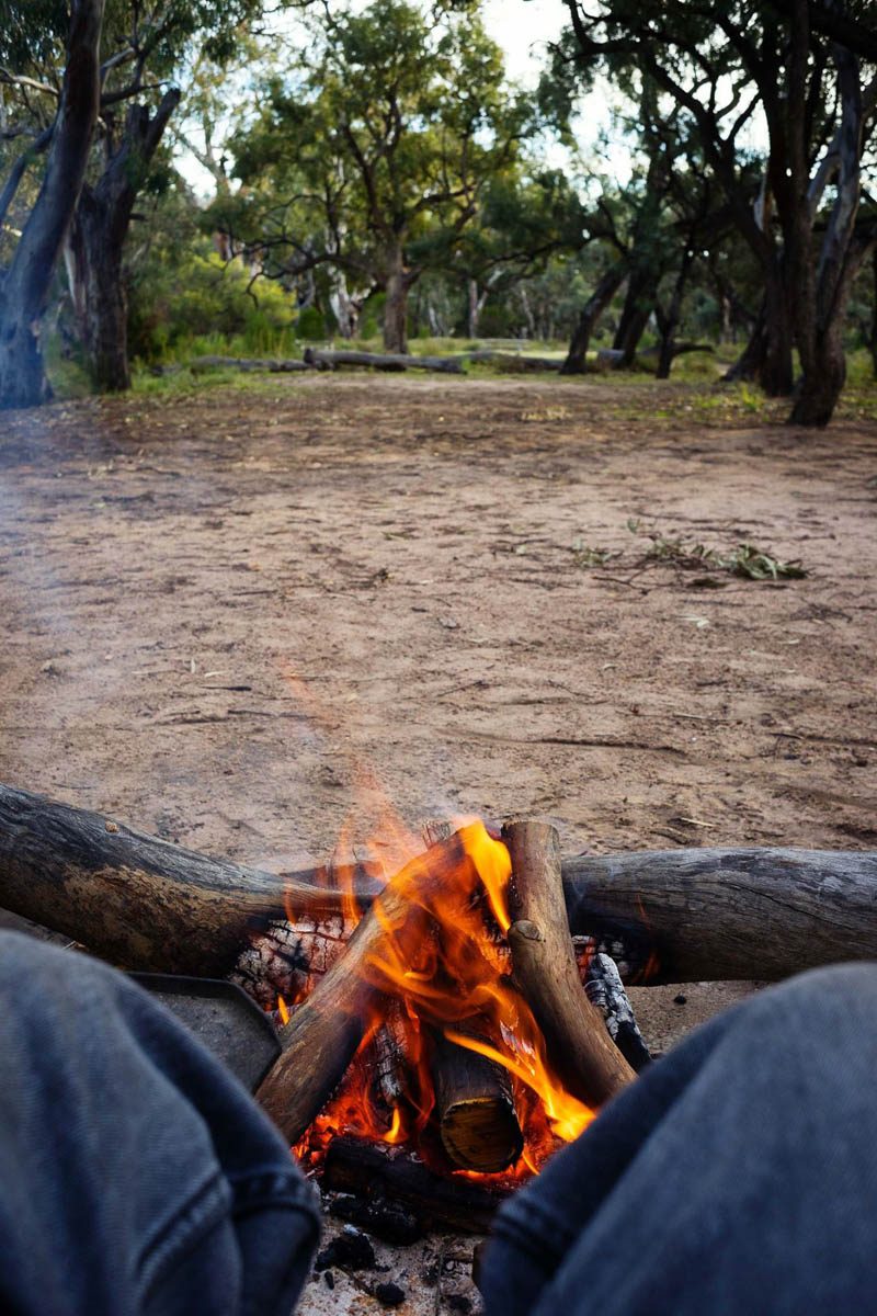
- Kicking back in front of the fire at Lake Mournpall

-
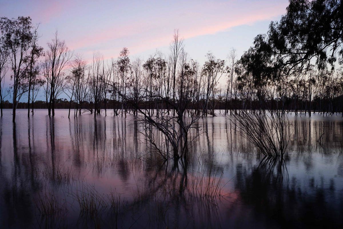
- Lake Mournpall at Dusk

-

- Camp Fire
-
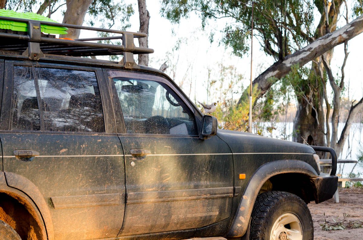
- Nissan Patrol that needs a wash

Day 3 – Heading Home from Hattah Kulkyne
Leaving Lake Mournpall via parks office near Lake Hattah, we realised that the main camp area (Hattah) was actually closed due to flooding, we walked down and found half the camp area underwater. Check conditions with Parks Vic before visiting.
-
- Flooded campground at Lake Hattah

-
- Flooded campground at Lake Hattah

This was the end of the trip, and as we headed back to Bendigo via Ouyen, we discussed re-visiting to explore the western section, including the Border Track. A four to five night trip would have allowed time to comfortably explore the entire area including some of the side tracks, so if you have time it wouldn’t be a bad way to spend the good part of a week.
When you’re contemplating what to do next Winter after the track closures hit in the high country, a trip to the Mallee is definitely worth considering, especially if you’re looking for something kid-friendly. The club has a trip planned in October 2018 to Little Desert, so if this sort of thing interests you, definitely check that out.
Vehicles:
- Tim (GU Patrol)
Don’t forget:
- Bring your own firewood, as firewood collection is illegal in national parks

Map of Mallee Drive (taken from Iconic Touring Route pdf)


