With Paul having Christmas and new year off for the first time in years, we decide to head away for a few days. The high country was our destination of choice we decided on the leave date of 27th December giving people time to enjoy Christmas with family and friends and Boxing Day to recover from having too much food and drink. We avoided the east Gippsland district as fires where all ready burning and every time we where in phone range we checked your phones for lasted updates on these fires and if there where any new ones. Our trip conclude on the Tuesday 31st December and this is when more fires started throughout the vic high country and still continue to burn today.
Day 1 Friday 27th December Bridgewater to Blue Rag Range
We packed up the cruiser and by 7:30am on Friday 27th December (temperature was only 17 degrees) we headed to Bunnings Epsom where we meet up with Nathan, Bailey, Shannon and Tom.
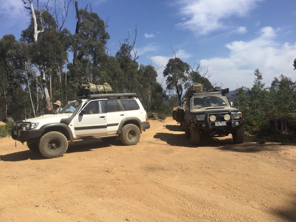
By 9:20am (23 degrees) we left Bendigo, traveling through to Violet town, then out onto the Hume Highway. On reaching the Glenrowan service station (11am), which we was quite busy we found a car park and had a smoko stop. Pulling out at 11:45am we continued on to Myrtleford where we all refuelled and then at the round about we turn right down the Buffalo river rd to the Ovens river, pulling into Nimo Bridge reserve for lunch (12:45pm). Tom enjoy some time in the river here to cool down as the temperature had reached 36.6. We left Myrtleford at 1:40pm, onto Bright we went through Harrietville then up the Great Alpine road by 3pm we reached the turn off for the Dargo high plains rd taking this we drove to the Blue rag range track, turning left and only needing to drive about 1km we decide not to air down or lock the hubs, but reaching a slight incline we discovered that the hubs did need to lock. After the hubs where lock we proceed the short distance in a bush camp (3:25pm), we set up camp and found some shade and enjoyed a catch up.
Around 5pm Steven and Jayne arrived with there daughter Charmaine and her partner Chaz they set up camp and then after some of us had tea, we left (6:30pm) to to drove up to the top of Blue Rag.
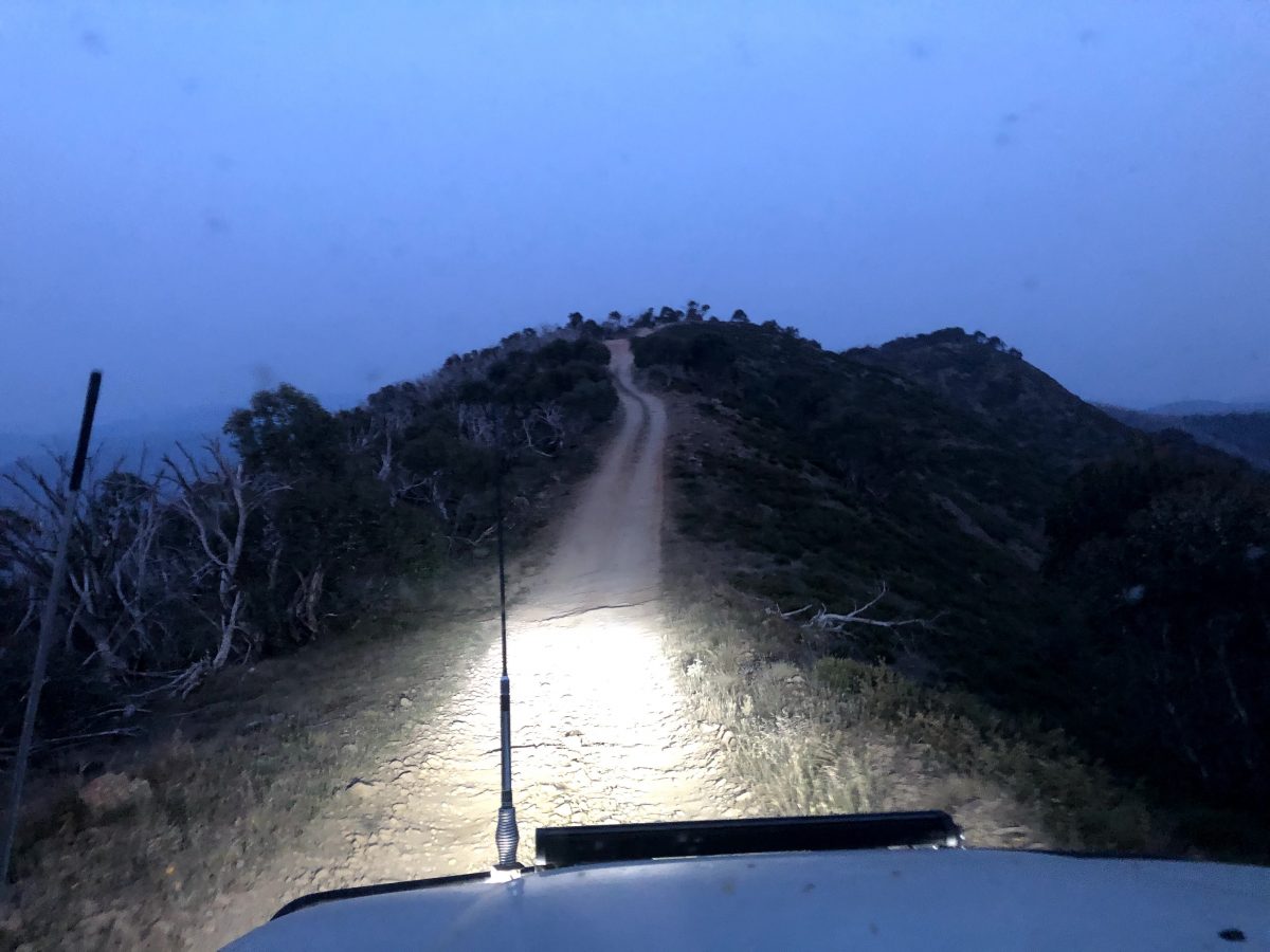
Turning left and heading down hill the track was dusty and a little rough we had to pick the best line through. We reached the up hill section where we had a nice little hole that we had to negotiate and not go over the edge reaching the top we turned right continuing along the Blue Rag Range track we arrived at the trig point at 7pm and watched the sunset while enjoying a drink and some nibbles. Some great photos where taken. With light slowly fading away we hopped back into our four wheel drives, put our headlights on a drove back to camp, getting back to camp about 9:20pm.
Day 2 Saturday 28th December Blue Rag Range to Collins Hut
Camp was being packed and Charmaine and Chaz said there goodbyes and depart for there trip home the rest of us had a debrief on the days proceedings, 9:10am we headed out of camp and turned left on to Blue rag range at the top of the track we turned left onto Basalt north track, we take a quick look from our 4wds at the old Railway carriage (This was originally a storage shed at Dargo Sawmill, then moved to current location as part of a logging camp), we followed this track for a little while then did another left on to Ritchie rd traveling along this track we spotted a tiger snake on the track which soon disappeared back up the embankment, a little further on in the area called white timber we pulled off on the side of the track and had morning smoko. (11am-11:30am)
Continuing on only a few 100 meters we discovered a nice camp spot near a creek we that we could have had morning smoko at, we will just have to remember this for next time.
Further on we saw a rare but lovely site of cattle grazing on the side of the track, these cattle belong to the treasure family who had brought there cattle up through Dargo a few days earlier.
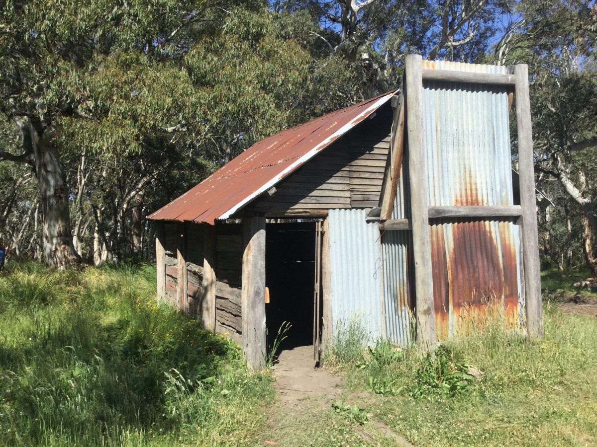
At the Dargo high plains we turned left and drove for a short distance then turned right down a unnamed track to Treasures/Mc Ewen huts, entering through the gate you spot three hut sites.
The hut was built in 1939 by Harry Treasure, which has now fallen down, the second weatherboard hut was built for Freda Treasure a her bedroom in about 1945 and is of split palings and the third hut was built in the 1960’s of weatherboards and is rather larger than the first two.
This was our lunch stop (12:30pm) which aloud us all to explore at our own pace. After lunch (1:10pm) Lachlan decided to travel with Shannon and Tom for awhile, we traveled back through the gate up the track and crossed over the Dargo high plains rd to Matheson track the first few kilometres where just a nice dirt track, then finally we reached the long decent to Harrison’s cutting, arriving here at about 1:50pm. Photos where taken and Tom and Nathan went for a swim.
Harrison’s Cutting is a 50m cutting which diverts a length of the river and allows the exposed river bed to be sluiced for alluvial gold. It is estimated that the construction date is in the 1880s.
Leaving there (2:15pm) we followed the tracks onto the Upper Dargo rd and by 3:05pm we pulled into the Dargo hall for a rest stop, then into Dargo stopping at the store.
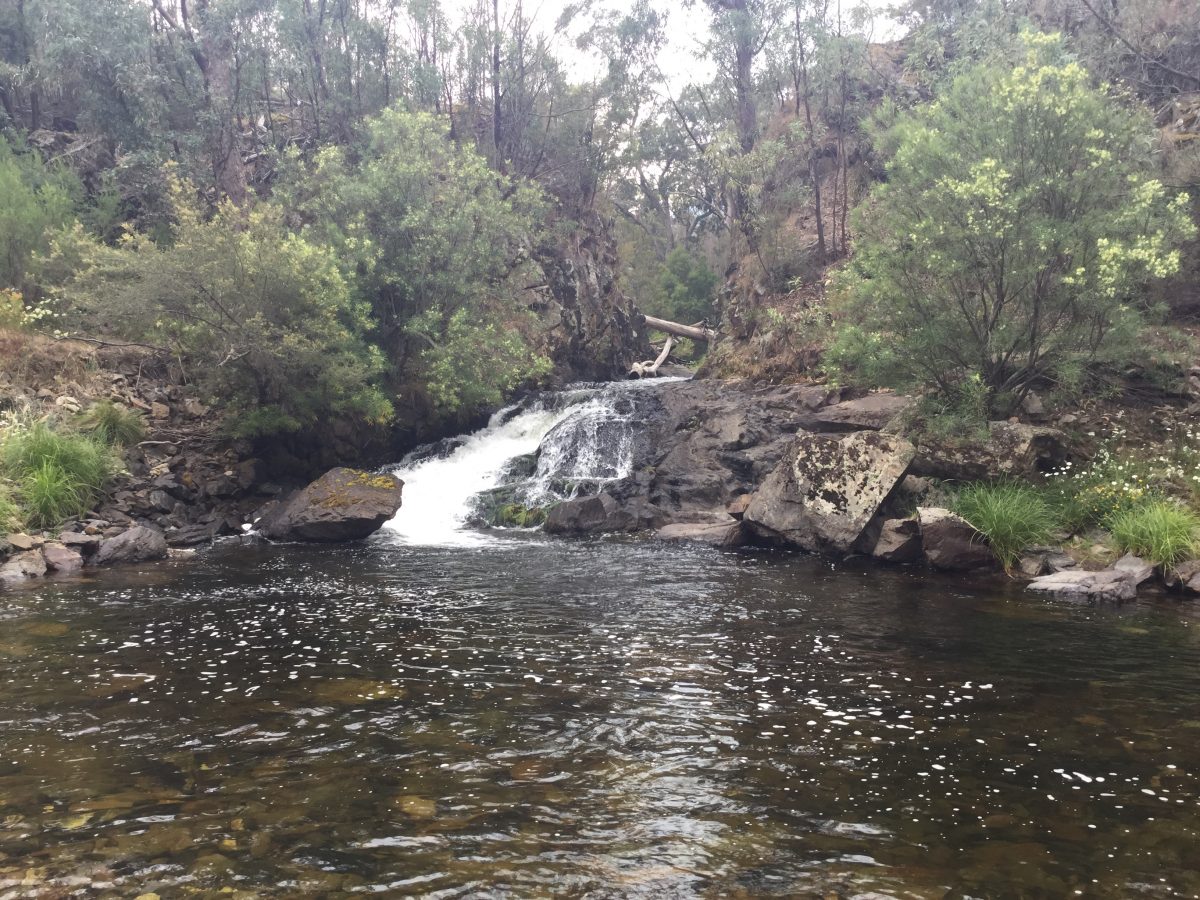
Departing the now busy Dargo we travelled out of town onto short cut rd the right onto Wonnangarra, to Scrubby creek track down to Collins hut (4:20pm), just prior to the hut we found a nice camp spot, we all set up camp. Keith, Lachlan and I went for a walk and discovered a access point to the river, we went back and told the others and we all went down a enjoyed a cold drink and chat with some even going in for a swim.
On return we cooked up some tea, while Keith and Lachlan where waiting they decided to go for a walk to the hut and have a explore around hoping to found a mine site that Paul had found on the internet. Two excited boys return to camp, they had found the mine. They proceed to tell us the location and informed everyone at camp. We all grab headlamps/torches and followed the boys to the mine. The Mine is located just opposite Collins hut and leads into the side of the embankment the mine is about 40 meters or so long. We went in in small groups to have a look around there was a grate across the walk way which had a ladder down leading to a lower level, some of us descended the ladder to have a look. Just pass this was another hole with a make shift ladder which no one was game to use. You could even see the old pick marks on the inside walls of the mine. Once the exploring was complete we went back to camp and either finished off tea or went down by the river, or sat around enjoying the sunset.
Day 3 Sunday 29th Collins Hut to Horseyard flat camp ground
By 8:55am we pulled out of camp drove back up the track turning left on Wonnangarra track down to Kingswell bridge (track name changes to Crooked river) we drove this track until we reached Randall’s track (9:55am). This track is generally a steep uphill climb, coming over a few of the erosion mounds it was hard to see which way the track went. On reaching the top (10:20am) we stop to take in the view (looking towards Billy Goat Bluff) and have morning smoko.
10:35am saw us descending down Conways track, by 10:58am we had reached the end of the track and pulled up the river near Kingswell Bridge to cool the brakes down before crossing the river. After a short break we cross the river and continue along Wonnangatta rd. At 11:20 the excitement in the group was high we had reached the start of the Billy Goat Bluff track, the only downside to this we found where all the other four wheel drive where with vehicles constantly going both ways on the track and stopped to take in the views. About half an hour after starting the track we had reached the heli pad where we stop to take in the views. From here Shannon led the way, we finally reach the rough section of track that everyone was talking about we all got out and took a look.
Once the track was clear Nathan proceed up the track, he then came over the UHF and said it was fine to continue on. This section of track was up hill, rough and dusty, followed by a rocky section, with some with a rear locker locked in and a correct line picked, we all got through with ease.
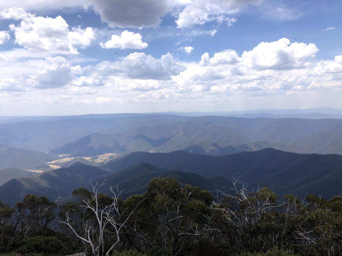
Shannon took lead again and we arrived at the pinnacles (12:45pm), the car park was busy so went back down the track to a clearing and had lunch. Following lunch we went back up to the car park (this time finding a spot) and we all walked to the Pinnacles fire tower. We took in the view and looking into the distance we could see the smoke and red glow from the East Gippsland fires. All safe where we where heading we descended from the fire tower to our vehicles enjoyed a cold drink as the temperature was 33.3 degrees then at 2:10 we left the Pinnacles car park and drove down Moroka rd to Horseyard flat camp ground (2:40pm). For the first few hours we had the camp ground to our selfs then later in the day two small groups arrived.
Pulling in to camp, we all set about doing our thing, setting up camp, swimming, chatting or enjoying a drink. Later (4pm) we all gathered around the picnic table for some nibbles and a look at the map at where the next part of our trip was taking us.
Later tea was cooked and a few of us decided to sit at the table to enjoy our meal, but not much enjoyment was had because we where smothered in flys. Nathan ended up giving up trying to eat anymore and placed his unfinished meal on the ground and within seconds his plate was black with flys. Around 9pm Jayne and Steven went off to bed, then the kids with the rest sitting around enjoying a drink and chat, heading to bed about 11:30pm
Day 4 Monday 30th December Horseyard flat camp ground to Low Saddle
With a hot day ahead and the flys back again annoying us we all packed up camp and by 8:15am we where ready to hit the tracks.
The convoy pulled out onto the road and up ahead Paul spotted two Alpine Dingos we inform the others and drove slowly as one had just got off the road and was standing at the edge of the bush watching us, we where lucky enough to get a photo and all the convoy got to see it. (The second Dingo just disappeared). Following Moroka rd we for a short distance then we turned left onto Moroka range track we started to see section of burnt ground from the fire that pass trough here 2018, we reached the track that lead to Mt Wellington we climb up the track to the top then continued onto to Moroka hut (10:20am). Arriving here we where hoping to drove out to Gable end and take in the views but unfortunately this track was closed, so we had morning smoko and had a look at the hut, we then went back up to the top of Mt Wellington to take in the view and get some photos, the only downside to this was the wind was quite strong and photos where hard to take.
Before to got blown away Nathan lead the way and we descend off Mt Wellington. We followed the track back to Moroka rd, At Arbuckle junction we turned onto Tamboritha rd and drove up to Kelly’s lane stopping in at Thomastown for lunch (11:50am) and a look at the map to decide where we going to head to next. A plan was decided upon and we lunch consumed we headed off (12:20pm). Back on Tamboritha rd then at the cattle yards we turned down Dingo hill track (12:30pm) the excitement was quite high to this track has no one in the convoy had done this track. We traveled down a slight decent then cross a bridge, the dirt track then continue on like most high country until we got to a set of multiple tight switch backs on a decline with a large drop over the edge. Once through these the track was back to normal with smaller inclines and descents, the track then turns into Caledonia river track (1:45pm, which meant that we started to go through multiple river crossing. Just a little side note Caledonia river track is renowned for having multiple deep bog holes but we fires traveling through this area in recent years the track has been graded and there is now no mud holes.
We traveled through one river crossing and we pulled up to have a 20 minute break, and dip our toes into the water to cool off, 2:20pm saw has rolling along the track again after a few kilometres we started on a steep incline to the Howitt high plains track. The incline was in stages which put the 4wds to the test especially as the day was quite hot. We all successfully made it to the top (3:20pm) and turn left to Howitt Hut. Arriving at the hut at 3:30pm we took another quick break and some photos of the hut. Here we said goodbye to Jayne and Steven.
Shortly after we pulled out onto to Howitt high plains rd and then onto King Billy track (3:50pm), we traveled along past the rock scree then though the river crossings continuing on we bounced through the track and then through some mud holes, reaching the end of King Billy (4:55pm) we traveled along Brocks rd.
We got to the turn off to Nobs track we realised the start of track had been cleared, as the Sandhurst 4wd club had done this track in the past when it was overgrown and a rough track we where curious if they had cleared the track went all the way to the heli pad or not. With a quick chat over the UHF it was decided we will drive it to find out. We reached the first incline of track and discovered it had also been cleared, we drove to the Heli pad on the graded track, there is no challenging sections now but the track is still a good steep drive. We traveled back down Nobs track and onto Low saddle where we found camp (6:45pm), the kids found the river and us adults set up camp and got tea cooking.
Once again the flys found us again so tea was consumed and dishes done us soon as possible. We sat around chatting and a reasonable early night was had by all as we where all getting attacked by bugs, even though we all had insect repellent on.
Day 5 Tuesday 31st December Low Saddle to Home
We woke around 6:30am to the sound of Shannons 4 wheel drive starting up, Him a Tom where ready to start there journey back home. After they left the rest of us had breakfast and packed up camp, as the flys where out and about bugging us we where on the road by 8:05am. We traveled along Brocks rd through Sheepyard and pulled into Mt Timbertop carpark (9:50) to air up then cruised on into Mansfield (10:15am), here we refuelled and grabbed a bite to eat. We left about 11:10am and headed to Murchison. Arriving here at 12:30pm, we had a cold drink and said goodbye to Nathan and Bailey and traveled our own way home from there.
Paul, Keith, Lachlan and I pulled into home at 2:55pm.(Bridgewater).
Everyone got home in time to enjoy the rest of New Year’s Eve with family and friends.
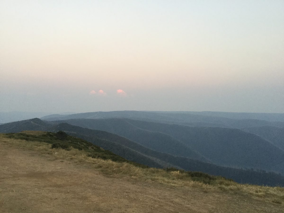
Blue rag 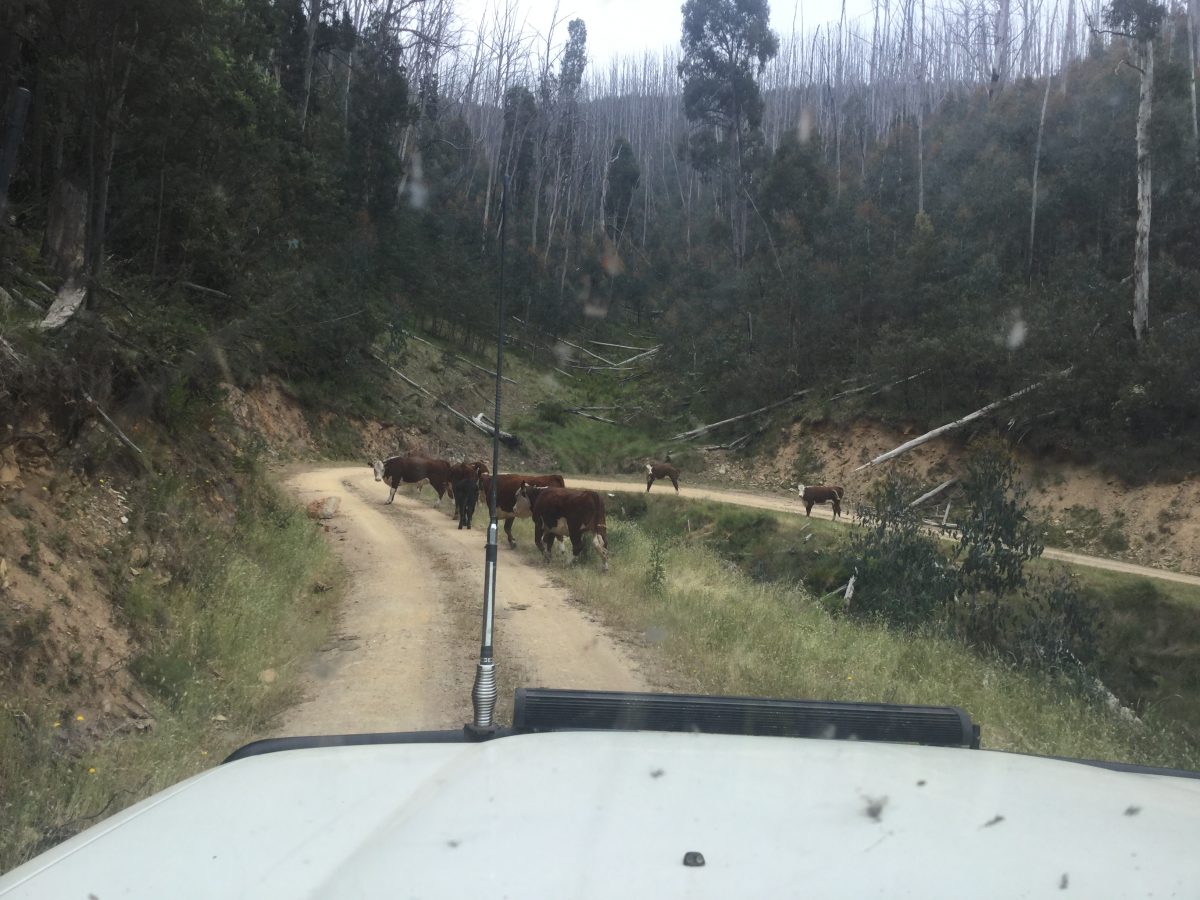
Tresure family cattle 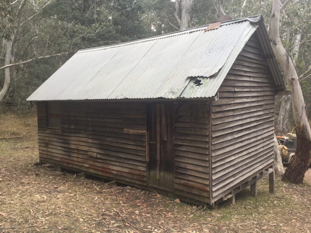
Tresure hut 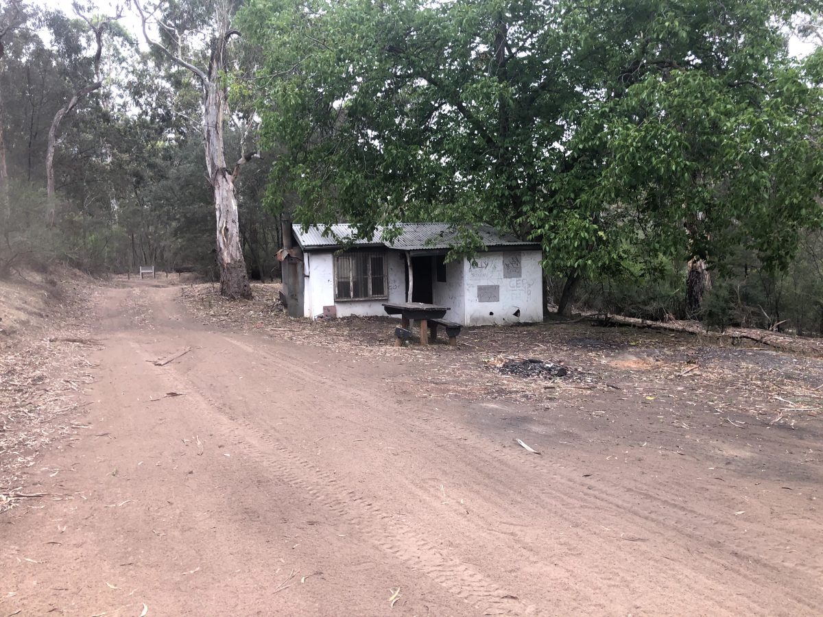
Collins Hut 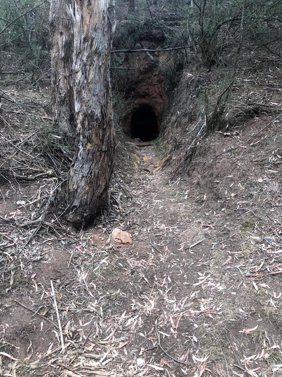
Mine at Collins Hut 
Mine at Collins Hut 
Mine at Collins Hut
Randall’s track 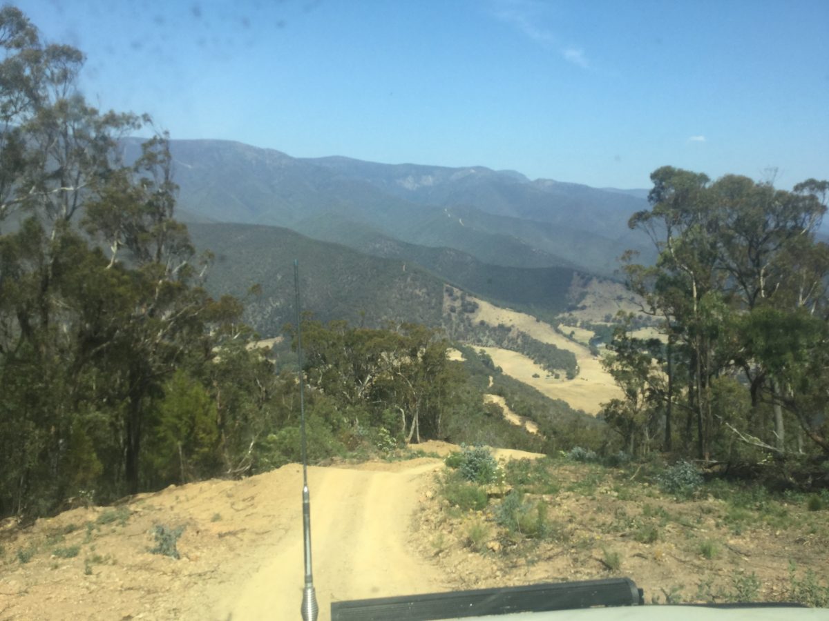
Conways track 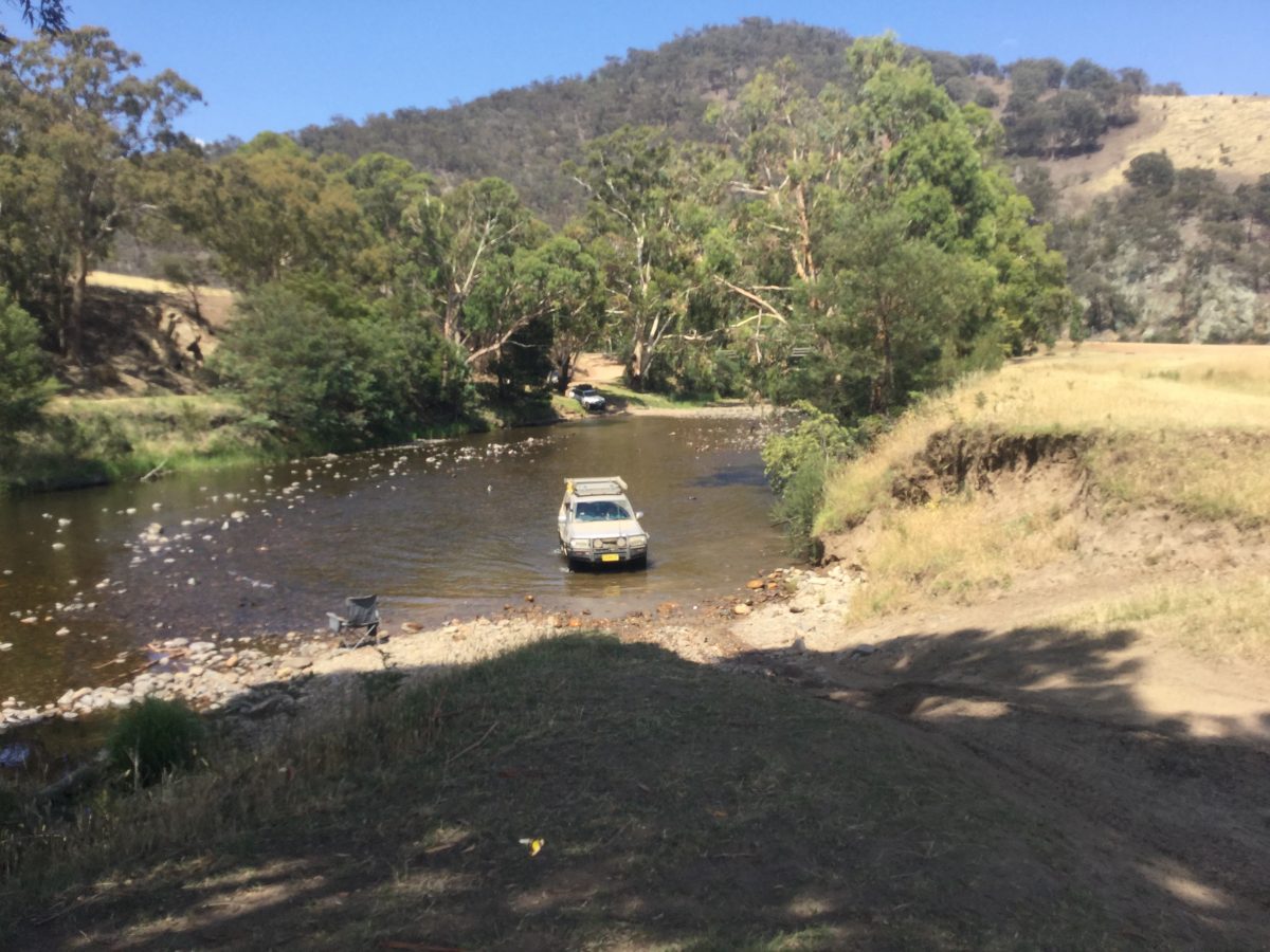
Kingswell bridge 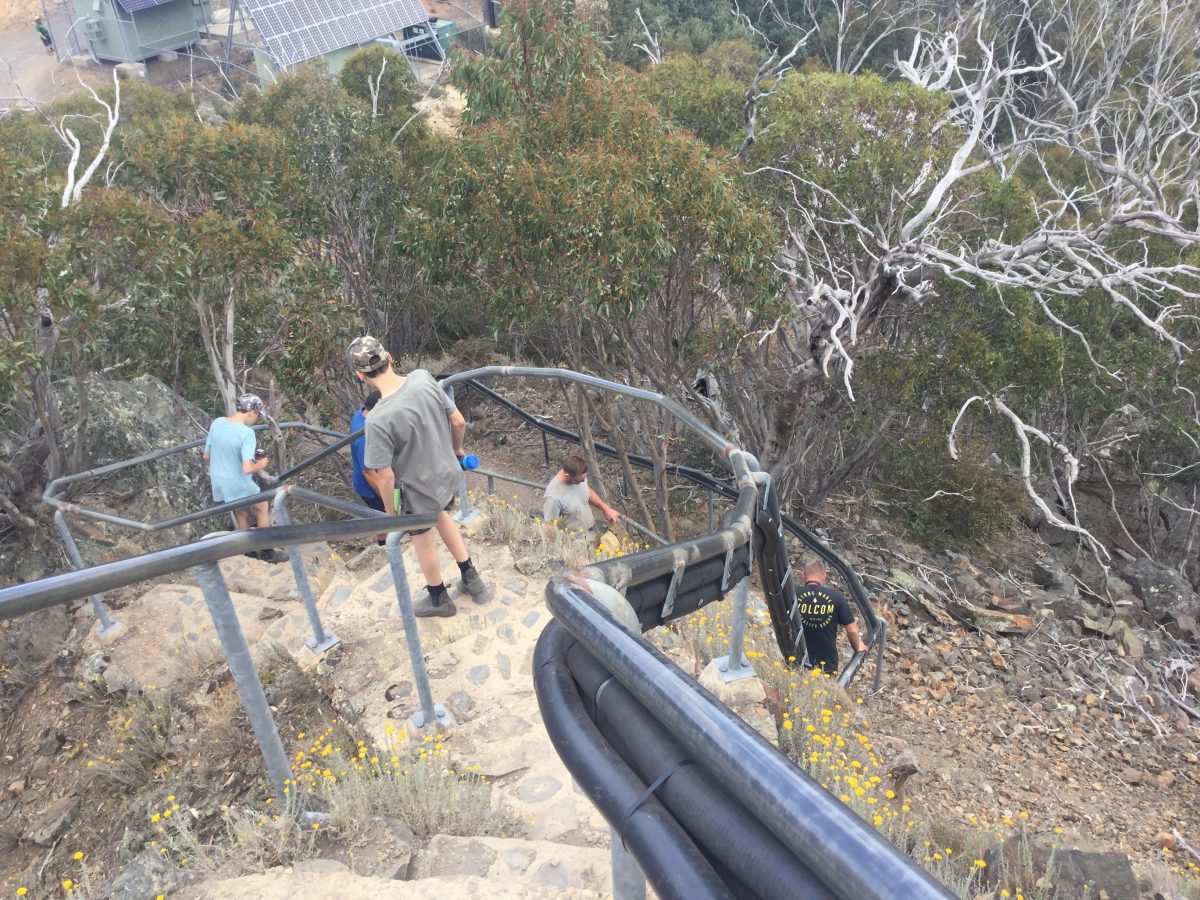
The Pinnacles
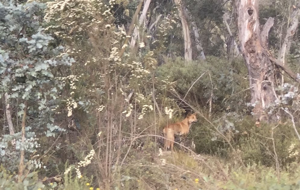
Alpine dingo 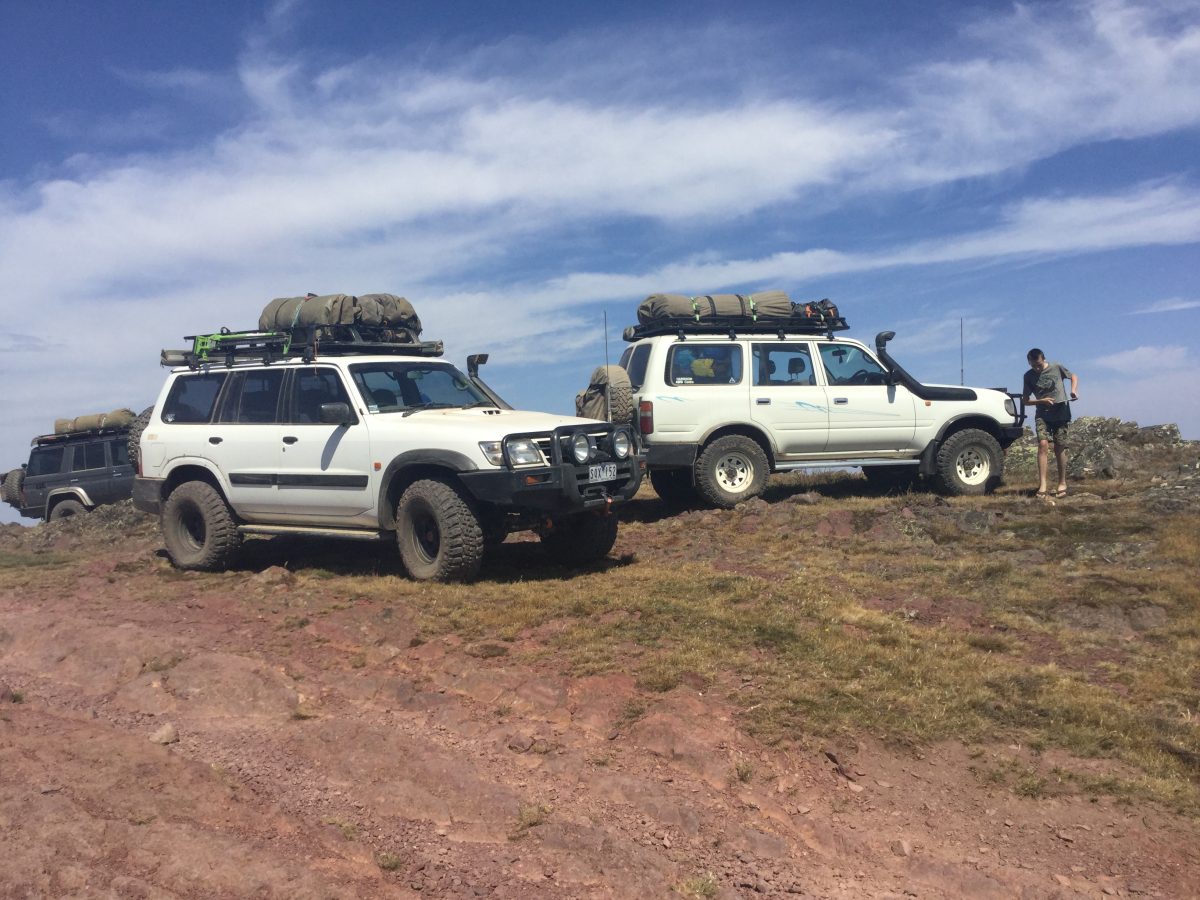
Mt Wellington 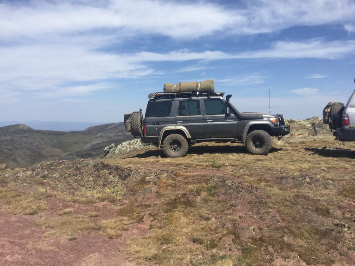
Mt Wellington 
Mt Wellington 
Dingo Hill 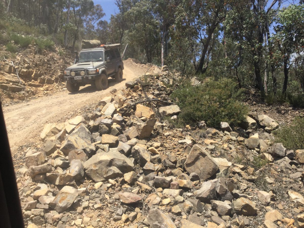
Dingo Hill 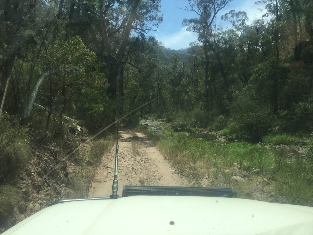
Caledonia river track 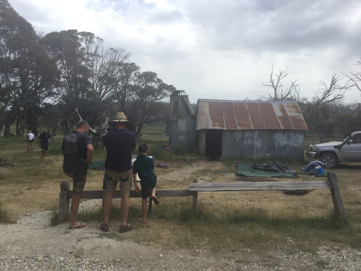
Howitt hut 
Heli Pad Nobs track 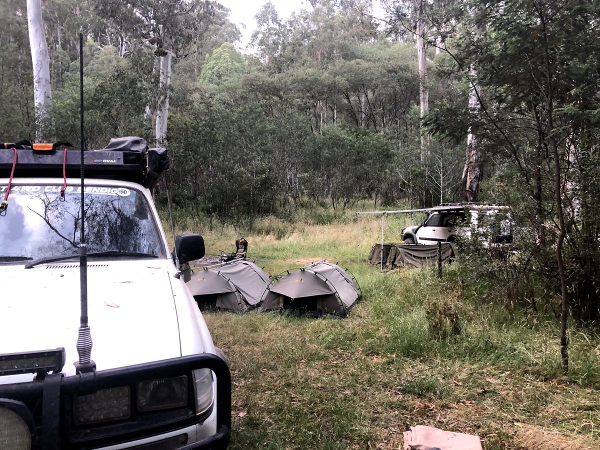
Low Saddle


